


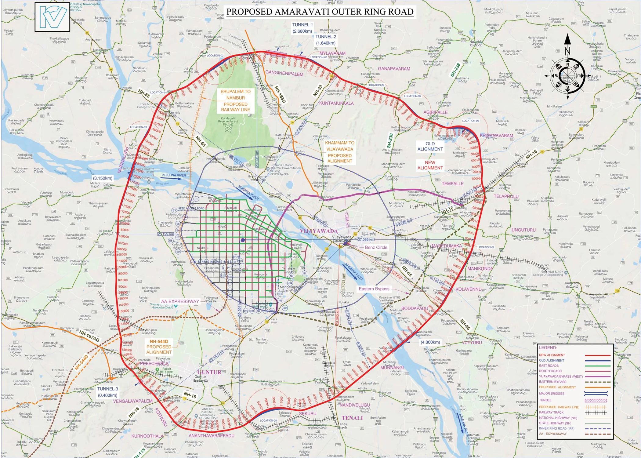
The Amaravati Outer Ring Road (ORR) is a significant infrastructure project in Andhra Pradesh, India, aimed at improving connectivity and boosting development around the capital region.
Here’s a summary of key details:
Length and Route: The ORR will span approximately 189 kilometers (though some sources mention 210 km), connecting five districts: NTR, Krishna, Eluru, Guntur, and Palnadu. It will pass through multiple mandals and villages within these districts.
Lane Configuration: The highway will be a six-lane, access-controlled expressway with service roads on both sides, planned to be 140 meters wide, according to the Times of India. It is designed for speeds of up to 120 km/h, with future expansion to eight lanes possible.
Project Components: The ORR will include two major bridges over the Krishna River, three tunnels, 51 major bridges, 78 smaller bridges, seven underpasses, and three road over bridges (ROBs).
Construction and Development: The National Highways Authority of India (NHAI) is constructing the ORR. The project was delayed during the previous YSRCP government but resumed on October 1, 2024, according to The New Indian Express. The Alignment Committee has approved the revised alignment plan with minor modifications. Land acquisition is underway in the involved districts.
Significance: The Amaravati ORR is expected to improve transportation and connectivity within the capital region, fostering industrial and economic growth. It will also boost the real estate market and create employment opportunities, according to Sri Savithru.
Note: There are slight discrepancies in the length mentioned in various sources (189 km vs. 210 km). The most recent updates indicate the project is moving forward, with land acquisition in progress and the Centre agreeing to a 140-meter width, according to the Times of India.

